

We all need nature
Right now, we are losing wildlife and wild places at an alarming rate and we need to protect them for future generations.
Help us restore nature in Northumberland, North Tyneside and Newcastle. Explore and learn about your local wildlife. Join more than 10,000 members, 600 volunteers and many enthusiastic communities and find out what you can do to help.

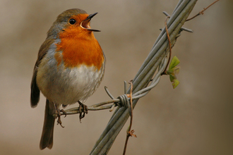
Image by: John Faulkner.
Nearby reserves and events
The Wildlife Trusts play a very important part in protecting our natural heritage. I would encourage anyone who cares about wildlife to join them.


Latest news
Wakey Wakey!
Northumberland Wildlife Trust is inviting members of the public to join in its celebration of International Dawn Chorus Day on Sunday…
Celebrities back last chance for UK Government to fulfil promise to ban sale of peat
Northumberland Wildlife Trust, together with celebrity supporters and forty-five other wildlife trusts, are urging the UK Government to…
Peat project going from success to success
It’s official! The Northumberland Peat Partnership (NPP) has now surveyed over 10,000 hectares (the equivalent of 12,355 football…


Keep in touch
Follow Northumberland Wildlife Trust on social media.


